Vote on Saturday Nov 15

Please vote. This is a critical election for the future of Vancouver.

From http://vancouver.ca/your-government/2014-municipal-election.aspx

Where to vote
You can cast your vote at any of about 120 voting stations around the city from 8:00am to 8:00pm on Saturday, November 15.

Find a voting location near you

What to bring to the polls
To vote on election day, bring your Voter Information Card to a voting station to make the voting process as quick and efficient as possible. If you are not on the voting list, you will need to show two pieces of identification and complete a voter registration form to be signed in front of an election official.

Policy Matters

This election, I voted for all the Vision candidates. This the first time in over 20 years I have not voted for any COPE or Green candidates. They lost me over their lack of support for the Broadway Subway and their campaigns that were based on attacks instead of workable solutions. I used to vote for one or two NPA people like Gordon Price and Peter Ladner. It is sad that they have abandoned forward thinking policies and instead focusing on forcing more speeding vehicles through communities with their poorly though out counterflow lanes idea.

For their strong leadership on cycling, I highly endorse Rob Wynen, Brent Granby, Geoff Meggs and Heather Deal. See below for more information.

For their (hopefully unsuccessful) attempts to using their opposition to the Kits Beach bike path for political gain, I strongly recommend NOT voting for  Stuart Mackinnon, Melissa de Genova, John Coupar and Anita Romaniuk.

As far as COPE goes, according to the polls, none of the candidates are even close to being elected. I don’t really know much about most of their candidates. It is sad that COPE chose not to work with Vision this time and the results will reflect that lack of cooperation.
It will be a close election. The real choice is between Vision and the NPA. It is pretty clear that Vision is the better choice.
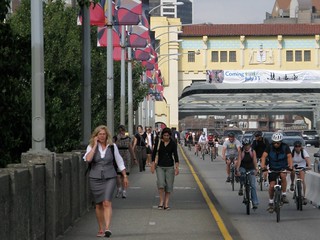
Cycling

As far as cycling goes, Vision has a good record of making improvements that have been in the plans for years although they have slowed down a bit last term implementing only one major cycling project, the completion of the Seaside Greenway in 3 years. The other big improvement was Burrard Cornwall, which is now could the best intersection in North America. There were several other cycling projects in the new transportation plan that were supposed to be implement by now. Although, to be fair, these were big projects. However, to meet our transportation and GHG emissions reduction targets, the pace really needs to be picked up.

Vision is willing to show leadership on issues like cycling, where, while there is angry opposition, the polling shows that the majority of people support these improvements.

For council, the Greens have a good cycling policy including separated bike lanes on streets like Commercial and Main although I am concerned they might not get much done due to endless consultation. So, considering cycling only, they would be worth supporting.
As far as the NPA goes, their cycling policy is weak and they are promising to “review” and possibly rip out Pt Grey. Sadly, COPE is promising a review as well. The NPA is also promising counterflow lanes which, even if they were practical, could add 30% more traffic to already busy city streets making our roads more dangerous for people walking, cycling and driving.

Broadway Subway

However, I didn’t vote for the Greens or COPE mainly due to their opposition to the Broadway subway. Their opposition and statements simply tells me that they just don’t understand transit and good urban planning. The information is out there. It is surprising that they have either not read it or are ignoring it. The study including the numbers below is here.
LaPointe’s point that he gets along better with the current Federal Government and thus is more likely to get money for transit is rather moot. By the time the funding for Broadway is really needed, there will likely be a new Federal Government that Vision is friendly with. Even if that is not the case, Prime Minister Harper is intent on wasted funds on reckless tax cuts that should be used for transit and other priorities leaving little for transit. The Liberals as well as the NDP have promised to reverse the irresponsible tax cuts and invest more in transit. Even if Harper did have the funds available, it is pretty clear that decisions of his government are mainly made on the basis of what will give them enough votes in key ridings that they need to win the election. Being a “friend” I suspect is of little value.

Reduced Demand on Busiest Section of Expo Line

As it extends the Millennium Line to Cambie making it easier for Millennium Line riders to transfer to the Canada Line downtown at Cambie, the Broadway is projected to reduce demand on the busiest section of the Expo Line by around 4,000 ppdph likely delaying the need to purchase more vehicles for the Expo Line, reducing pass-ups, delaying the need for costly upgrades and delaying the Expo Line from reaching capacity.

More Transit Use, Less Driving, Safer Streets, Less Pollution

2041 Forecast Peak Load (passengers per hour per direction, pphpd) of Broadway Subway to UBC is 12,500. And that will only be 15 years after completion. They should really be doing 30 year projections. No way LRT will have enough capacity unless train frequency is increased to the point that it really disrupts north south bus and pedestrian traffic and or slows down service along Broadway.

It is projected that the subway will attract 54,000 new transit trips per day by 2041 compared to only 11,000 for LRT. Over 30 years, the result will be a 2.3 billion reduction in vehicle kilometres travel for the Subway compared to only 1 billion for LRT. Even taking construction into account, the total GHG emissions reductions over 30 years for the Subway will be 335,000 tonnes for the Subway verses

Wider Sidewalks and Protected Bike Lanes 

Approved Improvements for Eglington

Underground transit on Broadway is a huge opportunity to transform the street making a great place to walk, cycle and enjoy public space. Possibilities include separated bike lanes and wider sidewalks
For an example of what Broadway could look like with transit underground, check out Eglington in Toronto where the rapid transit will be underground for 10km in the urban portion of the street creating space for protected bike lanes. Of note, the protected bike lanes were enforced by BIAs

Strong Endorsements

As already mentioned, I voted for and recommend all the Vision candidates. I’m convinced they will continue to make the improvements that we need in the city. I know Rob WynenBrent Granby and Geoff Meggs the best and strongly recommend them for their efforts to improve cycling as well as Heather Deal, who took a real lot of flack as the lead on Point Grey.
Rob Wynen who is running for relocation to School Board has been a strong support of cycling for years. I meet him when we were both volunteering with BEST 15 years ago. He was a key member of the Friends of Burrard Bridge that successfully advocated for the successful Burrard Bridge separated bike lanes.
Brent Granby has been supporting cycling improvements for years as well. He also was very active on Burrard Bridge.
Geoff Meggs did a great job of working for cycling improvements especially last term. He was a key on the Dunsmuir and Hornby separated bike lanes talking with a lot of businesses and stakeholders helping to address concerns that they had. He is very hard working, really understands complicated issues and listens to and helps resolve people’s concerns. Exactly the type of person we need on city council.

Who Not to Vote For

I definitely won’t be supporting Stuart Mackinnon, Melissa de Genova, John Coupar and Anita Romaniuk because of their opposition to the bike path at Kits Beach. Stuart especially is clearly trying to use this divisive issue for political advantage by attacking and using over the top rhetoric:
Hypocritically, both him and the other Green Party candidate (and the NPA) strongly support new pools in parks that will likely violate their no net loss of green space policy which was their excuse for opposing the bike path. A lot of concrete is required for pools which is another excuse that Stuart gives for opposing bike paths. While I don’t think pools should be a huge priority, I certainly would not oppose them. Some people like them. We need to be supportive of activities that others want to do in parks.

The Paths to Peace

Reducing Conflicts Between People Walking and Cycling

Our cities are quieter, healthier and more livable when we travel under our own power by walking or cycling. And, in general, are safer places for everyone as well. Still, with more people doing both, conflicts occur that can lead to injuries and in rare circumstances, death.Burrard Bridge

Sidewalk cycling is not allowed in most cases and can be dangerous for both those walking and cycling. Riding on the sidewalk opposite the flow of traffic is particularly unsafe due to left turning traffic. In Vancouver last year, it proved to be more dangerous for cyclists than pedestrians with both cycling fatalities last year involving sidewalk cycling. In the case of the tragedy on the Lions Gate Causeway, cyclists are required to use the sidewalk as cycling on the road is prohibited.

The two cycling related fatalities in the last decade have occurred when the pedestrian was crossing a road. In both cases, the causality was an older man. As is the case with motor vehicle crashes, we fare worse as we age. In the one on Main Street a few years ago, there was no indication that the cyclist was at fault. Still, a tragic incident reminding us all we need to slow down a bit and be careful on the road.

Unlike collisions involving motor vehicles, injuries crashes between cyclists and pedestrians and cyclists with other cyclists are not tracked in a systematic way making it difficult to know the extent of the problem. The Bicyclists’ Injuries and the Cycling Environment study which examined hundreds of injuries to cyclists in Vancouver and Toronto found that around 4% of cycling collisions involved pedestrians. By comparison, almost 70% involved motor vehicles.

The Provincial Government, TransLink and municipalities continue to make improvements that governments that reduce conflicts and make cycling and walking safer. Still, its a big province. There is a lot of work still to be done.

Many of the older bridges in the region have sidewalks and approaches that are simply too narrow for cyclists and pedestrians to share without conflicts happening. Fortunately, the Province is widening the sidewalks on Ironworkers Memorial Bridge as we speak. Improvements are still needed on the south approaches. The City of Vancouver is planning on improve Granville Bridge. One option is to build cycling and walking paths in the middle of the Bridge by reallocating a couple of lanes of traffic.

Separated bike lanes significantly reduce sidewalk cycling. On Dunsmuir and Hornby, they decreased by 80% following the completion of the bike lanes. Similar reductions have occurred in other cities following the introduction of separated bike lane. The Burrard Bridge separated bike lanes and the Burrard Cornwall intersection improvements make cycling and walking much nicer.

Shared paths have higher injury rates than separated paths. However, they can work fine when there are not that many people using them. When volumes are higher, over 200 people hour or so, conflicts increase due to cyclists passing pedestrians and slower cyclists. The best solution is to create separate walking and biking paths like those along newer sections of the Seaside Greenway in Vancouver. Unfortunately, the badly needed separated bike path in Kits Beach Park, which would have greatly reduced conflicts, was rejected.

Smooth paths are best for heels and wheels. Walking paths should be surfaced with smooth asphalt, saw-cut concrete or machine cut granite. People don’t like walking on bumpy surfaces and often will use the paved bike path next door. People also like to walk side by side. If the walking path is narrow or interrupted with obstacles like poles or benches, people will walk in the bike path. A perfect example of this is the path by the new convention centre where many people stroll in the bike path.

Paths should have clear sightlines giving cyclists plenty of time to react to people walking or cycling across the path. A parallel street with bike lanes or low levels of traffic can provide faster cyclists with another option.

There is an election coming up. A good idea to support candidates that campaign positive solutions that reduce conflicts and make our communities safer for everyone. Check out HUB’s Vote to Bike initiative!

$45 Million for Cycling, Walking & Transit in Draft Capital Plan

Badly needed improvements for walking and cycling on the Granville and Cambie Bridges are along the projects including in the City of Vancouver in draft capital plan for 2015-2018. Also in the plan is a long overdue upgrade to the Burrard Pacific intersection. The total amount for new cycling, walking and transit totals $45 million over the four yours. As TransLink is responsible for the majority of transit funding, most of the $45 million will be devoted to cycling and walking.

The Granville Bridge is currently the worse in the city for cycling. Not surprisingly, the cycling commuting levels are much lower in the area south of the bridge than in other areas of Vancouver the same distance from Downtown. Making the Bridge safer should dramatically increase the number of people cycling to work.

Other cycling improvements listed are the completion of the Comox Helmcken Greenway and the upgrading of the Adanac, Ontario and 10th Avenue Bikeways so they are safe and comfortable for people of all ages and abilities. For walking, the plan features pedestrian safety and public realm improvements in the Downtown Eastside, Marpole, Mount Pleasant and West End community plans.

Not mentioned are separated bike lanes on Commercial Drive which are on hold waiting for the completion of the Grandview Woodlands area plan. Also not included is the completion of the Portside Greenway nor separated bike lanes on Smithe/Nelson, a big network gap downtown.

The final plan will go before voters for approval this November following public consultation over the next few weeks and approval by council in the fall. What actually gets implemented will depend on the next council so make sure you support candidates who support cycling.

Never hurts to send a quick email to Mayor Gregor Robertson and Council mayorandcouncil@vancouver.ca supporting investment in cycling and walking.
More info on the Capital Plan including public consultation: http://vancouver.ca/your-government/capital-plan.aspx

Bike Path on Powell Street Overpass to Open Soon

20140721-014802-6482563.jpg

The $50 million Powell Street Overpass, expected to be completed in early August, will have a separated bike path on the north side stretching from Hawks Avenue to Clark Drive. This will be a big improvement for cycling in this part of town. Unfortunately, there not yet a good cycling connection west of Clark. Vancouver’s Transportation Plan included a cycling connection from Clark to McLean but it is uncertain when it will be completed.

The  $105 million proposed for renewal of transportation infrastructure in the draft Capital Plan includes funding for the repair of Water Street. The renewal of Water Street will be the ideal opportunity to improve it for cycling by either adding cycle tracks or by closing the street to through commuter traffic. This along with improvements to Powell and Alexander, would complete the Portside Greenway giving residents and tourists a great connection to East Vancouver, Burnaby and the North Shore.

A good idea to let the candidates in the upcoming election know that completing the Portside Greenway is a priority.

Burrard Cycle Tracks Worth Considering

The upgrades to the Burrard Cornwall intersection are almost finished. The improvements include separated bike lanes from the Bridge along Cornwall to Cypress and along Burrard south to 1st Avenue. These badly needed improvements are fantastic and will help encourage more people of all ages to ride bicycles both for daily trips and recreation.

Sewer, water and road construction work is scheduled on Burrard from 1st Avenue to 16th Avenue starting in 2015. This presents an idea opportunity for the City to improve Burrard Street for cycling and walking building upon the great work on Burrard Bridge and the Cornwall intersection.

Currently, Burrard south of 1st is a miserable place to cycle and walk. Typically, the narrow sidewalks are right next to the speeding traffic. In spite of the traffic, a significant number of brave souls still cycle on Burrard. For some trips, it is more direct than the alternatives plus there are many businesses and shops along it.

Cypress, the current bike route is not much better north of 4th Avenue. At Cornwall, there are almost 500 vehicles on Cypress in the afternoon peak hour. This around the maximum traffic volume acceptable over 24 hours for a road to be safely and comfortably accommodate cyclists of all ages. Many of vehicles are making turns that will cause conflicts and pose a danger to people cycling.

According to ICBC, both Burrard and Cypress have fairly high levels of cycling collisions. From 2008-2012, there was at least one collision at each intersection from 10th to Cornwall. In 2012, there were 7 collisions from 12th to 1st along Burrard while there were three on the same section of Cypress. In 2011, both streets had five each from 16th to 1st.

2011 Census Cycling Commuting Mode Share - City of Vancouver

2011 Census Cycling Commuting Mode Share – City of Vancouver

As shown in the map, the cycling mode share in areas served by Burrard, Pine and Cypress (6%-9%) is significantly lower than other areas (9%-15%) of Vancouver similar distances from downtown. Moreover, while cycling in the areas east of the Dunsmuir Separated Bike Lanes increased significantly from 2006 to 2011, areas to the south of the Hornby and Burrard Separated Bike Lanes did not increase over this period. This is likely due to the lower quality of the bike routes feeding Hornby and Burrard compared to Adanac Bikeway.When Burrard/Pine/Cypress are improved, it would be reasonable to expect cycling levels to increase to 10% to 15%.

Upgrading narrow local streets like Cypress and Pine to accommodate all ages cycling quite challenging. Either enough traffic needs to be diverted off it to reduce volumes to 300-500 vehicles per day or separated bike lanes need to be added. Especially with the diversions introduced with the York Bikeway, diverting traffic off Cypress may be difficult while maintaining basic access for residents and businesses. Furthermore, with the high turnover of customer parking, it may not be possible to reduce levels enough. To add separated bike lanes, parking would need to be stripped from one side of Cypress and the street would need to be converted to one way. Some residents and businesses won’t be too keen on this either.

Burrard, on the other hand, is wide enough to accommodate separated bike lanes while maintaining access and parking at least during off-peak hours. While the number of travel lanes between intersections would need to be reduced from three to two, right turn lanes would help maintain vehicle capacity near current levels.

Burrard - South Side of 4th

Possible lane configuration for Burrard just south of 4th Ave

One option worth considering is one-way separated bike lanes (cycle tracks), on both sides of Burrard from 1st Avenue to at least 10th Avenue. On two-way streets with a lot of cars turning at intersections and driveways on boths sides, cycle tracks can be safer than a two-way path on one side.

Burrard - South Side of 5th

Possible lane configuration for Burrard just south of 5th Ave. On-street parking could be allowed evenings, weekends and off-peak weekdays.

Burrard provides obvious direct connections to Burrard Bridge. Using either Cypress or Pine will result in cycling longer for some trips and may involve crossing busy Burrard more times. People that drive who are considering cycling will know that Burrard is a bicycle route. They may never realize that side streets like Cypress are bike routes.

Having the cycle track between the traffic and the sidewalk will make Burrard much more pleasant to walk along. And, as with the case with Hornby, collisions will likely be reduced making the street safer for everyone, including people in cars. The City should quickly study options for improving Burrard, Pine and Cypress to determine the best options before the planned work starts on Burrard.

Take Action A good idea to write Mayor and Council, mayorandcouncil@vancouver.ca, thanking them for the Burrard Cornwall intersection improvements and encourage them to make Burrard, Cypress and Pine better for all ages cycling.

SkyCycle: Would it Fly in Vancouver?

Riding along elevated bicycle highways passing over busy roads without having to stop. Imagine the Dunsmuir Viaduct without any motor vehicle traffic. A SkyCycle in Vancouver would be really wonderful. For the most part though, unlike London, there is typically space available near rail lines here making elevated paths on top of them unnecessary. Still, there are a few spots where elevated structures would make cycling a lot better.

Central Valley Greenway

A 750m elevated walking and cycling path from Grandview Hwy North and Clark to near the Home Depot over the False Creek rail yards was seriously considered a decade ago as part of the Central Valley Greenway. Unfortunately, it was killed for budget reasons leaving cyclists to contend with the 13% grade up to Clark by VCC and forcing them to cross two legs of the busy Clark and 6th intersection.

Since it follows the railway, the Central Valley Greenway has a lot fewer stop lights than parallel roads like Broadway and Lougheed Hwy. Last time I used it, I didn’t hit a red light between Caribou Road and Rupert Street. Little would be gained elevating this section. On the narrow section between Lillooet and Boundary, the SkyTrain is elevated leaving space on the ground for the Central Valley Greenway.

Portside Greenway

With the completion of the Powell Street Overpass this summer, the section of Powell Street between Clark Drive and Wall Street will be the only missing link in the Portside Greenway. An elevated path over the railyard in the Port is certainly one possible option. A less expensive solution would be to reallocate a lane of traffic on Powell Street to create a separated bike path.

Low Level Road

The new Low Level Road currently under construction in North Vancouver will include painted bike lanes on both sides of the road. However, with high vehicle speeds and lots of trucks, it will not be a great cycling route for people of all ages and abilities. On the north side, cyclists will be sandwiched between the traffic and a tall concrete retaining wall. Yikes! The Spirit Trail is the alternate route. Unfortunately it is much longer, very hilly and is further from the water.

A bicycle and pedestrian path over the rail yard would be a much better option. Hopefully they will built it soon once they realize that people really want bicycle paths separated from traffic that are flat and by the water.

Cornwall Separated Bike Lanes – Balsam to Arbutus

The City is doing a fantastic job improving Point Grey Road west of Trafalgar and the Burrard Cornwall intersection making them much safer and more comfortable for people of all ages to cycle on. These great facilities have the potential to encourage many people of all ages to cycle if there was a safe obvious direct connection between them. York may work well for commuters but it does not connect to Kits Beach nor will it appeal to people wanting to  enjoy the view.

The separated bike lanes on Burrard Bridge and Hornby Street are well designed and have the capacity to handle thousands more bicycle trips per day. Connecting them to the vastly improved cycling facilities along Point Grey Road with separated bike lanes along Cornwall is the best solution for ensuring the safe access to the Seaside Greenway west of Trafalgar.

According to ICBC collision reports, this is the most dangerous section of Cornwall. The staff presentation on the Seaside Greenway states that 28 of the 51 reported collisions (including dooring)  from 2008 to 2012 involving motor vehicles along Cornwall/Point Grey occurred on Cornwall East. Of the collisions on Cornwall East, the vast majority of them occurred from Balsam to Arbutus with the most dangerous intersection being Vine. As cycling traffic will likely increase on this section of Cornwall, the number of collisions will likely increase unless improvements are made even if some of the bicycle traffic is diverted to York. As bicycles can pick up some speed on this downhill stretch, it is especially important to provide separate paths for the safety of people walking and cycling.

With the plans for a bike path in the Kits Beach Park not looking good at all, now is the time to look for alternatives. With Point Grey Road down to two lanes of traffic further west, it is likely that four lanes of traffic are not needed between Balsam and Arbutus.

A two way separated bike lane could be created on the north side of the street by reallocating a lane of traffic on Cornwall from Balsam to Arbutus. In addition, the curb lane on the south side of the road could be made a bit wider perhaps reducing the risk of dooring. No trees would be lost and no green space in the park would be affected although some grass in the Cornwall right-of-way would be lost mainly to create parking bays.

Cornwall - Balsam to Yew - Tree

As there would still be three lanes of traffic, off-peak parking could still be maintained on the south side of the street. By allowing off-peak or 24 hour parking on the north side between Yew and Arbutus, the total number of parking spaces would be increased (9 more is a rough estimate) more than compensating for ones that are lost between Balsam and Yew.

Cornwall - Balsam to Yew - Parking

All the bus stops could be maintained so there would be minimal impact on transit users. By encouraging more people to cycle on the bike lane instead of the road and by enabling more people to cycle instead of drive, bus travel times could even be slightly improved.

Completing this badly needed connection will help ensure that lots of people will enjoy cycling along this route for both transportation and recreation. Without this connection, the number of people cycling along Point Grey will likely be significantly lower. There will also likely be more sidewalk cycling, people cycling in the road along Cornwall and more people cycling on the narrow shared paths in Kits Beach Park creating conflicts with pedestrians and motorists increasing the chances of pedestrians and cyclists being injured.

The section of Cornwall from Arbutus to Cypress is more challenging. Some options will be discussed in the next issue of WeCycle.

Please write City Council mayorandcouncil@vancouver.ca thanking them for the improvements to Point Grey Road and the Burrard Cornwall intersection and encouraging them to make further improvements along Cornwall.

Kits Beach for All

IMG_1468

Cycling is one of the most popular forms of recreation enjoyed by residents and visitors of all ages. By Science World, over 5,000 people cycle past on a nice day. As with all the paths by the water, many people cycle along Kits Beach with their children. Sadly, with even neighbourhood streets having fast moving traffic, these paths are the only places many feel safe cycling with their families.

With the Seaside Greenway improvements further west along Point Grey Road due to be finished soon, most likely many more people will want to cycle and walk along Kits Beach making the path even more crowded. The rough path worn in the grass is a clear sign more space is needed.

Sharing the narrow path along the beach and through Haddon Park is not great for people walking or cycling. When passing, riders should let walkers know by ringing their bell or with their voice. But when there are so many people walking and cycling, the constant bell ringing and “on your lefts” can be very annoying for everyone. People also like to walk side by side chatting in groups of 3 or 4. That just is not feasible sharing a narrow path.

A separate bike path will make the park more enjoyable and safe for many people. Two decades ago, a separate bike path was build by Sunset Beach and English Bay. This is a solution that we know works.

It is people that make an urban park. Many of those people enjoy activities on paved and cement surfaces. Yes, grass would look nicer than the tennis or basketball courts but without the tennis and basketball players Kits would not be the same. It would lose part of what makes it exciting, vibrant and attracted; people.

The survey of people using the park, found that 42% of people cycle in the park and 93% thought that separated cycling and walking paths would be a good idea. The planned cycling path will only occupy around 3% of the total park space. As so many people cycle and walk in the park, this seems like a good use of this space.

The City’s Physical Activity Survey found that 20% of adults cycled on a regular basis, 5% played tennis. Basketball did not make the top 18. For children, biking was at 10% while basketball was at 16%. Tennis did not make the top 21. Surely if space can be made for these activities, the same can be done for cycling.

I’m one of the lucky ones who live near the beach walking down there pretty much everyday. Most people are not so fortunately. Given that only so much parking near Kits Beach, cycling is one of the only options that many people can realistically use to get to the beach. Judging by the large number of bikes at the beach, many people do just that. More people cycling instead of also decreases the impact on the neighbourhood and the chances of people driving, walking or cycling getting injured in a crash.

There are many options to significantly or reduce the net amount of grass lost in the park. Part of the path could be placed on Cornwall or Arbutus Streets. Parking space in the park can be reclaimed. Some of the existing paths can be narrowed or reclaimed as greenspace.

Over at Sunset Beach, more and more of the parking lot gets reclaimed for other activities as time goes by. Part of the Kits north parking lot would make a great picnic area. It is nice and flat and close to the beach. Maybe it is possible to redesign the larger south parking lot to fit the same number of cars in less space.

While sadly, it is impossible to be sure how Harvey Haddon, the philanthropist who generously donated the park to the people of Vancouver, would have felt about the bike path. The deed does state that improvements can be made for people to enjoy recreational activities safely while keeping it as close to a natural state as possible. Who knows for sure but it is indeed possible if he could witness all the families cycling along the water around, that he would approve such a path.

So, instead of lawsuits, it would be great if everyone including Park Board, the City of Vancouver, beach user groups and area residents sat down to work on solutions. Lets make Kits Beach great for everyone walking, cycling, jogging, playing tennis, shooting hoops, picnicking, swinging, climbing or just enjoying the view.

Please write City Council mayorandcouncil@vancouver.ca and Park Board PBcommissioners
@vancouver.ca
 encouraging them to find a solution.

Burnaby Leads in Including Separated Bike Lanes in Street Plans

20131024-210256.jpg

The City of Burnaby has had the foresight to include separate bike lanes in its street plans for Lougheed and Willingdon in Brentwood Town Centre. As new developments are completed, the separated bike lanes are built adjacent them. As shown, in the photo, the first section on has been completed on the south side of Lougheed a block or so west of Lougheed.

This is a cost-effective method to adding bike lanes that doesn’t impact other users that much if at all. The downside, of course, is that it can take decades to complete the bike lanes leaving gaps in the meantime.

In this respect, Burnaby is leading Vancouver which has yet to include separated bike lanes in the street plans for the majority of arterial streets although there proposals to include them on the streets adjacent to Oakridge Mall and along Great Northern Way as part of the Central Valley Greenway. Still, there are no plans to include separated bike lanes on obvious streets such as Main and Kingsway. Main has a high number of cycling crashes which should make it a priority for improvements. Kingsway, along with streets including Burrard south of 1st, Nelson and Smithe were identified as candidates for bike lanes way back in the 1997 Transportation Plan. Burrard south of 1st will be torn up in 2015 for waterworks. This would be an ideal opportunity to add separated bike lanes at a low cost while minimizing traffic disruption.


As the majority of shops and businesses as well as an increasing number of homes are on main streets, separated bike lanes along them are critical to enable people of all ages to safely, conveniently and comfortably use bicycles in their daily lives.

Kits Beach Bike Path Safer for Everyone

Cycling is very popular. A recent BCCC poll found that 70% of adults cycle at least once a year. Bicycle paths along water and through parks are attractive places to cycle with 66% saying such paths  would encourage them to cycle more often. Separated paths are even more important for parents with children. A survey of people using the park, found that 42% of people cycle in the park and 93% thought that separated cycling and walking paths would be a good idea. The planned cycling path will only occupy around 3% of the total park space. As so many people cycle and walk in the park, this seems like a good use of this space.

Anyone who has cycled or walked along Kits Beach on a sunny summer day should realize that the current narrow shared path leaves much to be desired. Heading downhill from the Maritime Museum onto a path covered with sand dunes crowded with people more interested in looking at other people than lookout out for bikes can be quite dicy. Judging by the bicycles parked all over the place at Kits, many people already bike to the beach, pool, tennis courts and the basketball courts. The soon to be completed Seaside Greenway improvements west of Kits Beach will likely result in more people cycling on the Kits Beach path increasing conflicts if no action is taken.

With this in mind, the plans for the Seaside Greenway presented to the public earlier this year included bike paths through Kits Beach and Haddon Parks. After the parts of the Greenway on city streets were approved by council back in July, Park Board staff consulted the people using the parks on improvements for people walking and cycling. Not surprisingly, an overwhelming majority thought that separate paths for cycling and walking would improve safety.

Realizing that the path along the beach is very busy and a lot of people walk across it or stand and chat in it, the bike path was routed way from the beach, the basketball court and the playground to near Arbutus Street.

Some have suggested that people on bikes should use the road instead. While this might be fine for experienced adult cyclists, clearly this is not an good option for children and less experienced adults. In the summer, the roads near the beach are crowded with cars. Drivers are more focused on looking for parking or at the pretty people walking than children on bikes.

Separate bike paths along the water have been very successful in Vancouver at reducing conflicts between people cycling and walking including fifteen years ago along English Bay and Sunset Beach. Fifteen years from now, people will wonder what all the fuss was about.

Some opponents try to paint this bike path as a high-speed highway where speeding cyclists will endanger other park users. The reality is that the path will be mostly used by residents and visitors cycling responsibly with their families enjoying the spectacular scenery. The vast majority of people on bikes are careful not wanting risk injury to themselves or other people. Those who want to ride fast will continue to ride on the road. Yes, like with any form of transportation, a few people on bikes behave recklessly but it really unfair to punish everyone else on bikes for the actions of a few.

There are bike paths in parks around Vancouver and the world that pass by playgrounds and picnic areas without any major safety issues that I am aware of. The path will be further away from the playground than the current path that cycling is allowed on. It is hard to see how this path in anyway will endanger children or anyone else in the park.

The bike path will also take the long route around the hill creating a more gradual downhill slope helping to minimizing the speed of bicycles further improving safety for everyone.

Fortunately, on October 7, Park Board approved the bike path and pedestrian improvement to Kitsilano and Haddon Parks. Commissioners Constance Barnes, Sarah Blyth Aaron Jasper and Trevor Loke voted in favour of the bike path. Commissioners John Coupar and Melissa De Genova voted against the bike path. Commissioner Niki Sharma was not present.

Take Action

A good idea to send a quick thank you to Park Board, PBcommissioners@vancouver.ca in support of the cycling and walking improvements in Kitsilano and Haddon Parks.

More Info

Seaside Greenway Improvements – Park Board Report

In the Media

Park board chair says bike path painted at Kits Beach is made up | Georgia Straight

Bike lane at Kits Beach won’t destroy the world | Georgia Straight

Kits bike path route not yet finalized – Commissioner says path might be tweaked

Park board chair responds to Kitsilano Beach Park bike path controversy | Georgia Straight

Committee will address rumours over Kits Beach bike lane – Misconceptions include trees being cut down

Pete McMartin: Over-the-top reaction to Kitsilano bike lane marks disturbing trend

SEEN IN VANCOUVER #471 | Bike Lanes, Or The Fascist Nightmare Destroying Kitsilano : Scout Magazine

Kudos and Kvetches: Kits Bike Lanes and Other Important Complaints

POLL: Do you support the new bike and pedestrian path linking Hadden and Kits Beach parks?

Over the Top Anti-Bike Rhetoric Done Well

Taking two-wheeled demons and the hellions who ride them to task – Blogs – Vancouver Courier

The Classic! Video – Death by Bicycle — Dorothy Rabinowitz on New York City’s new bike-share program